
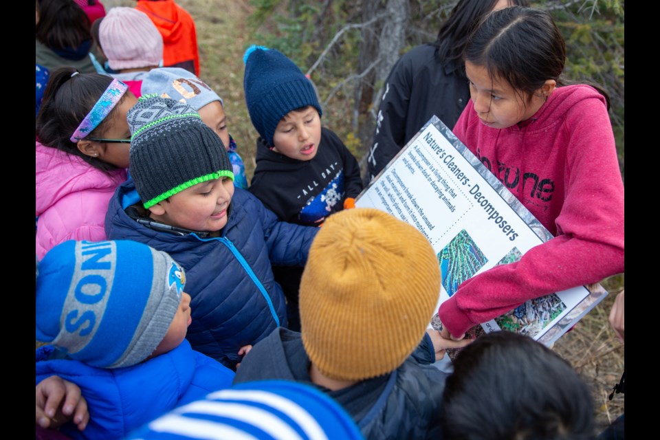
EXSHAW – The South Exshaw trail, once washed out almost entirely by the 2013 floods, has been rejuvenated with an educational flare.
“The 2013 Floods” and “Moss in the Rocky Mountains” are among some of the newly named interpretive signs adorning the popular trail that students from Exshaw School created and then presented during its grand opening on Tuesday (Oct. 22).
“It was fun,” said Kelton Poucette, who helped to make a sign that describes the flood and how it impacted the area, washing away the old trail.
“It’s important because you get to see what happened, like you can see piles of sand and driftwood … I hope it gives people something to see and to learn about.”
Exshaw School was awarded the Alberta Professional Engineers in Geoscience Association (APEGA) innovation in education grant, which Grade 7 and 8 science and literacy teacher, Michelle Kulmatycky says enabled them to put the project together.
“We come out here every year and hike as part of our career and technology foundations course and every year, it’s such a beautiful trail, but there’s no information on it,” said Kulmatycky.
“It just tied in so nicely with a Grade 7s interactions and ecosystems unit in science and the Grade 8 water unit in science and so why not make some signs to put out here to share with everybody so they can actually learn something every time they walk through.”
From a casual hike in the outdoors to a newfound educational project complete with QR codes that link to student-made websites, Kulmatycky said the students chose their topics based on their own interests.
“It started as a hike and them taking pictures of everything they were interested in and it went from there. They formed into groups based on their interest and it took all year, but it was well worth it – and now they’re pretty excited to actually see their names on the signs,” she said.
“Now they’ve got something very tangible – I mean talk about making learning visible, here it is.”
The signs themselves are spaced out along the trail and cover geoscience and historical aspects about the surrounding area. Students worked together in groups of three to create the signs, using information from their class as well as their own research. The QR codes link to websites the groups made with further information on the signs, which Kulmatycky said can be changed yearly by different students working on the same units in science.
Dretin Goodstoney, who also took part in creating the interpretive signs, said though he had “a little bit of fun,” it was at times tedious work.
“It took a lot of time and effort,” he said. “It is cool, though.”
Located near the MD of Bighorn, the South Exshaw Trail is roughly 3.1 km running in part along the Bow River. For more information on the students and their work, visit the Exshaw School website.


