
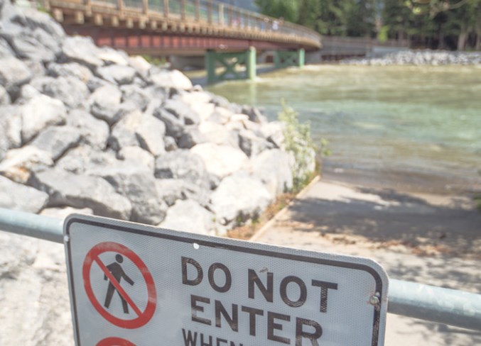
CANMORE – The Bow River did not breach its banks in Canmore in 2013 when most of southern Alberta experienced a major flooding event, but it came close and was a major cause for concern for many residents of the community.
That concern around the possibility of the river flooding in the future was expressed at various public meetings since the flood. But while municipal efforts are focused on the hazard and risk assessments of mountain creeks for flooding, the Bow River itself is the jurisdiction of the provincial government.
Post flood, the municipality considered conducting a fulsome assessment of the hazard and risk of the river to the community, but in 2015 backed away from those plans acknowledging it is the province’s responsibility.
More than five years later, Alberta Environment and Parks has still not provided the public with an updated flood assessment of the Bow River, even though it has progressed toward full river hazard studies for 13 other waterways in the province.
The provincial public affairs bureau did not grant the Outlook’s request for an interview on the status of the Bow River hazard study, but in an email response spokesperson Kate Toogood indicates substantial progress has been made on studying both the Bow and Elbow rivers.
“While project timelines were extended last winter to include additional analysis, all project components are now in the late stages of completion,” Toogood said. “Even if everything is not yet finalized until the spring, municipalities and First Nations will be given the most complete information available before the spring runoff season, including inundation maps.
“After all components are complete, municipalities, First Nations and the public will be engaged to provide technical feedback on river hazard study products.”
Until 2013, the province only considered three possible flood scenarios for the hazard map for the Bow River, and used the 1:100 year event for its flood plain mapping. The province committed in 2015, however, to understanding
13 different scenarios as part of this update, ranging from 1:2 year to 1:1,000 year events.
Those additional scenarios, along with an inventory of structures affected by the maps and a river channel stability assessment are part of the reason the work has taken so long, according to provincial officials who have spoken with the Outlook in the past. The last update from the province on the study indicated it would be completed last spring.
The Upper Bow River Hazard Study began in fall 2014 and involved mapping of the 220 kilometres of the river from its headwaters in the mountains to the eastern reaches of the watershed.
One of the concerns expressed by Canmore residents post 2013, was whether or not the berm along the river in the community is still adequate. The berm was built after the 1974 flood. The study is expected to determine if the flood mitigation infrastructure is still adequate given changes to the river over the past 45 years.
The river hazard studies for the rest of the province is expected to provide updated and detailed hydrological assessments for 1,300 kilometres of river, affecting more than 30 communities.
Even though the updated river study is not yet publicly available, provincial officials have committed to providing the information on flood plain and fringe areas to municipalities for the use in emergency response planning and development approvals.
The effect can be seen already in Canmore, with new development occurring above the flood plain elevations identified by the province. New development along Bow Valley Trail, like the Super 8 and Basecamp, sit at a higher elevation than the buildings that are older along the roadway as a result of the flood plain changes.


