
CANMORE – Just as an extreme cold alert is lifted for the region when temperatures plummeted, a snowfall warning has been issued for Canmore, Kananaskis Country and other areas of southwest Alberta.
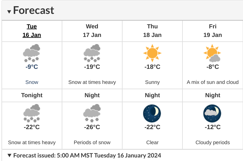
Snow will be heavy at times, with total amounts of 15 cm to 25 cm expected, according to Environment Canada, before tapering off overnight Wednesday (Jan. 17) and into Thursday morning (Jan. 18).
"Snow will begin late this afternoon bringing heavy snow overnight tonight and through the day on Wednesday,” states the warning issued just before 5 a.m Tuesday (Jan. 16).
The highest snowfall is expected to be in the extreme southwest of the province, near Pincher Creek and Waterton National Park.
Banff is not included in the snowfall warning at this time.
Drivers are advised to be cautious given visibility may be suddenly reduced at times in heavy snow.
“Surfaces such as highways, roads, walkways and parking lots may become difficult to navigate due to accumulating snow,” states the alert.
“Prepare for quickly changing and deteriorating travel conditions. If visibility is reduced while driving, slow down, watch for tail lights ahead and be prepared to stop.
During the extreme cold snap of last week, Banff set a new temperature for Jan. 12, when the temperature plunged to -39.8 C. With records kept as far back as 1887, the old record was -39.4 set in 1916.
To report severe weather, send an email to [email protected] or tweet reports using #ABStorm.
ECCC Snowfall warning in effect for forecast areas. For location details visit: https://t.co/WP3TTsf8ck (6:36am) #ABRoads #ABStorm pic.twitter.com/qG0eKwjhLP
— 511 Alberta (@511Alberta) January 16, 2024


