
BANFF – Tree-ring climate data from the Canadian Rockies have informed us many drought cycles have occurred since the 1600s, each leaving their mark on the landscape by allowing large areas of the subalpine and the montane to burn as full stand-replacing fires.
We are in a severe drought cycle, compounded by the effect of climate change. Our fire season lasts longer and temperature maximums are setting new records. Recent fire seasons are showing combined high temperatures, plummeting relative humidity and increasing wind conditions beyond those used during the development of wildfire behaviour models in the 1970s-80s.
Wildfires are now commonly burning in their most extreme and damaging form (99th percentile conditions - or “very rare”). Like engineers who build reservoirs or bridges that can sustain the rare 1000-year flood, emergency preparedness measures should be developed for worst-case scenarios.
The Rockies’ subalpine is ripe for burning. With this ongoing drought across many regions of Canada, we are likely in for another bad fire season encompassing numerous forest fires. When many fires occur at once, there simply are not enough resources to action all fires and a triage takes place.
Mid-July last summer, a wildfire burning a few kilometres away from Whitehorse had a single helicopter and a skeleton fire crew at its disposal as all resources were deployed elsewhere in the country. We are in a different era; emergency response plans must be updated to reflect these new realities.
In recent years, fires have been burning under out-of-the-norm conditions: burning at night and moving great distances – 10s of kms, prompting late evening, or middle of the night, last minute evacuations.
The 2017 Waterton Lakes National Park Kenow Fire burned nearly the entire park overnight, moving rapidly downslope under high winds. In mountainous terrain, fires burn rapidly upslope and winds accelerate in narrow valleys due to pinching and tunnelling effects.
Banff is nestled in just such topography at the confluence of the Bow, Spray and Cascade valleys, where fire can approach from various directions. While there is a solid fire guard on the backside of Sulphur Mountain, science has shown fire risk is not just from the side of prevailing winds. The reality is Banff is not evenly protected. Fire mitigation measures are still a work in progress and are an ongoing maintenance process due to vegetation regrowth.
FireSmart guidelines for communities set in forested areas were initially published in 1999 by the Alberta government. In spite of personally raising this issue in 2018 and again in 2023, and I believe was previously raised by Parks Canada, our Town still uses spruce trees – the most flammable species – as part of their own landscaping projects, which increases the fire hazard within the Town.
This practice goes against the now globally well-accepted FireSmart guidelines, which are to remove easily combustible vegetation within 10 metres of infrastructure and to space out combustibles within the 30m defensible zone. Fire risk reduction is a shared responsibility and the onus is as much on property owners as it is on municipal and federal land managers in our case.
A great read is the book Fire Weather by John Vaillant who studied the case of the 2016 Fort McMurray Fire. Hindsight is always 20/20. The reality is government wildfire experts understood the risk clearly, but city managers weighed in the implications of needlessly alarming residents and causing an evacuation that would have an important economic impact on the oil industry.
Let’s not fool ourselves. It will be an agonizingly similar decision our officials will have to make with regard to alarming citizens and tourists alike and the economic impact of evacuating a town at the height of tourism season. It will result in a last-minute evacuation.
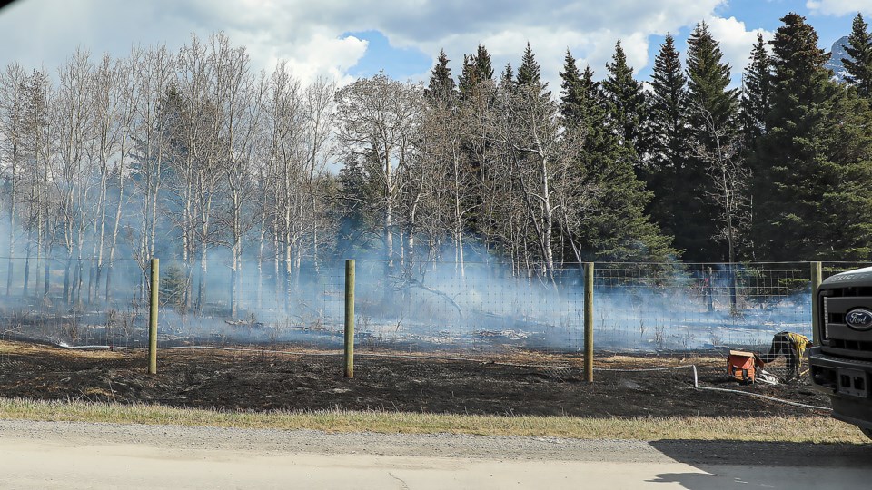
The May 2023 escaped Compound Meadow prescribed fire is a good example. The after action review report of the incident shared by Parks Canada revealed at 4:15 p.m., the green light was given to send an emergency alert. Yet, the Town sent the alert to residents at 5:05 p.m. This is a 50-minute delay and the message completely downplayed the potential risk.
Wildfire computer simulations showed without adequate fire suppression, fire spread was reaching residences in about one hour. Hopefully, there have been good lessons learned from this incident.
It is time to hear from our new fire chief and our Town officials as to how they will address this new wildfire risk environment.
Marie-Pierre Rogeau has more than 30 years of experience in fire research and is a fire ecologist and wildfire scientist living in Banff. Her master's degree researched the fire history of Banff National Park and her PhD focused on fire regimes and the effect of topography on fire frequency in the Rockies.


