
BOW VALLEY – The snowpack may be above average in certain parts of the Rockies, but the chance of a major flooding event like five years ago remains low, according to the director of the Coldwater Laboratory with the University of Saskatchewan.
John Pomeroy said the snow pack is higher than normal in several areas upstream from Banff and Canmore, however he down-played concerns this could lead to flooding when temperatures begin to rise.
“Right now it simply means there won’t be a drought at least early in the summer,” said Pomeroy. “Early stream flows will be healthy and that’s a good thing.”
That being said, he pointed out there are several factors to keep an eye on in the weeks and months ahead.
“What we have to watch out for is if the snow pack hangs on well into June at the high elevations. Flooding would depend very much on a large rain storm coming in,” said Pomeroy.
“What happened last time is we had about 250 millimetres of rain that occurred over three days, but there was roughly 100 millimetres of snow-water equivalent in the high elevations and a lot of that melted at that time, so it added another 100 millimetres on top of the 250.”
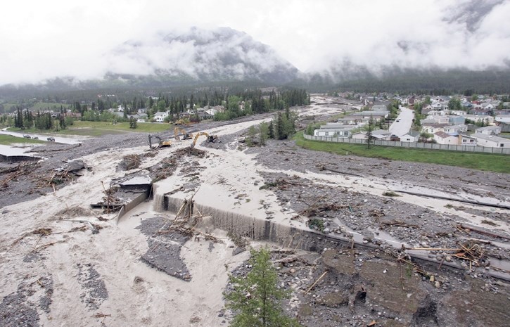
In June 2013, a deluge of rainfall across the eastern slopes of the Rocky Mountains combined with a late snowpack and saturated soil, resulted in major flooding from Canmore to Calgary.
Compounding matters, local mountain creeks designed to channel water were unable to accommodate the increased flow, spilling their banks and in turn damaging hundreds of homes and critical infrastructure.
According to Pomeroy, the snowpack at Skoki Mountain, near Lake Louise, is currently sitting around 400 centimetres, about 75 cm higher than normal for this time of year. A little further east at Sunshine Village the snowpack is about average.
At Little Elbow Summit, in Kananaskis Country, the snowpack is also above average, sitting at 450 cm, about 75 cm more than normal.
While the snowpack may be higher than normal in some places, Pomeroy said the right conditions have to align for a major flooding event to occur, including a heavy rainfall event, warm temperatures and a heavy snowpack into June.
“Until we get into May and June, in particular June, we will know better,” said Pomeroy, adding it appears the next few months will be cooler than normal, but it’s unclear if it will be wetter.
“Cooler is good in a sense that instead of it coming down in rain it’s coming down as snow, but snowmelt by itself wont cause flooding.”
Regardless of how things play out, he emphasized people should always be prepared.
“We’re in an era now of extraordinary extremes in weather as the climate has shifted, so it’s always quite possible to see something we’ve never seen before.”


